Two Creeks Track
About
Start/finish: Begins at the corner of Slade Avenue and Tryon Road, East Lindfield. If you begin the walk here, you need to pass under Eastern Arterial Road via the stormwater tunnel, which may not be passable after rain. Alternatively, you can access the walk from the corner of Tryon Road and Eastern Arterial Road near Lindfield Oval.
The track ends at Roseville Bridge but alternatives are possible (see map below), making your walk a circuit and returning to Lindfield Oval.
Distance: 6 km
Duration: 2 hrs one way
Difficulty: Moderate – steep, rough sections and steps.
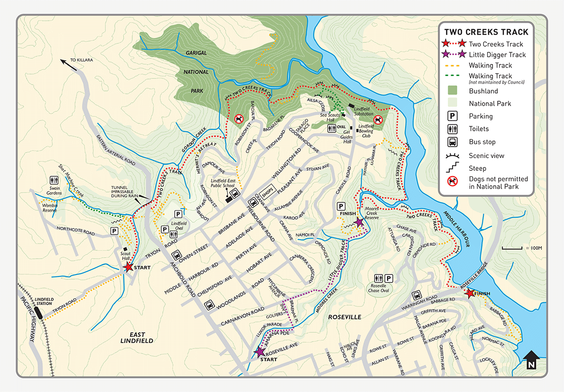
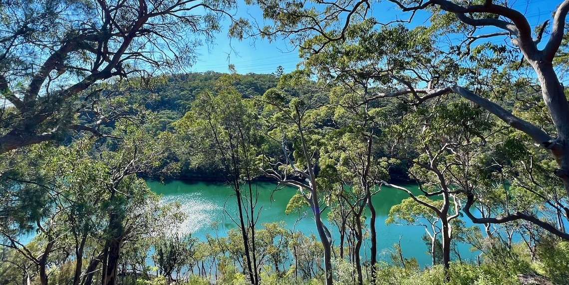
Description: This long walk circles East Lindfield, descending beside Gordon Creek to Middle Harbour and continuing along Middle Harbour to Roseville Bridge. Along the way you will see post-war cobbled tracks and stonework, views of mangrove forests, salt marsh and sweeping water vistas and vegetation communities ranging from moist gullies to Sydney sandstone gully bushland.
Beachwatch water quality for Echo Point Davidson Reserve
View Two Creeks Track brochure(PDF, 1MB)
More info: 9424 0000 or email krg@krg.nsw.gov.au.